🏔️ Get the free Colorado Springs Local Cheat Sheet
A 20-year local’s shortlist, best taco, best hike, the Garden of the Gods timing trick, and more. Plus a short weekly email on what’s happening around town. Free.
Checked October 5, 2026. If you are leaf-peeping near Colorado Springs this week, do this: go midweek to Mueller State Park and the Highway 67 corridor first, while the high stands still hold. Then use North Cheyenne Canyon or Pikes Peak Highway for the lower and mid bands as the month rolls on. Skip waiting for one magic “peak weekend.” High color above about 9,000 feet already peaked in late September and is fading. From The Gazette, October 2, 2026, Mueller was at peak then. From Springsmag, citing Peaks2Plains and OpenSnow, in-town peak runs roughly October 5 to 19. From FallingIntoFall, Pikes Peak Highway peak centers around October 9 (window about October 4 to 14).
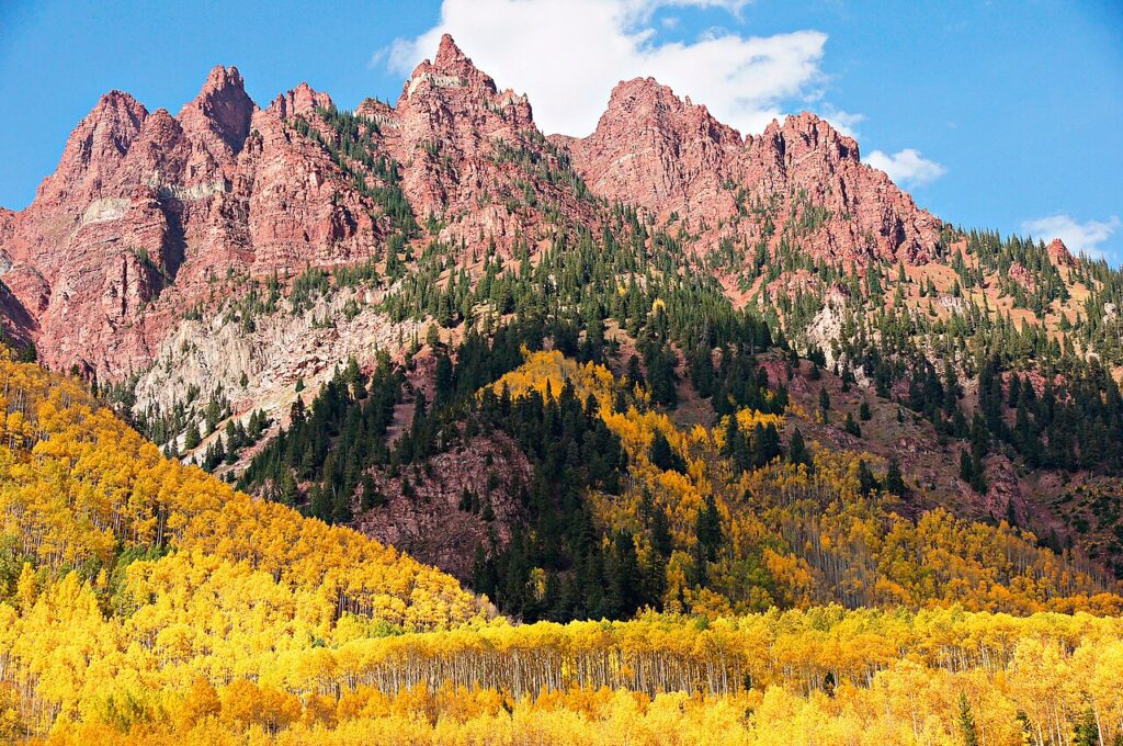
I’ve lived in Colorado Springs over twenty years. Fall is still the season that gets me outside the most. Gold aspens against dark pine and red rock do something a phone camera never quite holds. The rest of this page is how I’d plan around what is actually turning right now.
When the Color Moves, by Elevation
There is no single peak week here. The city sits around 6,000 feet and the mountains behind it push past 10,000, so color rolls downhill for roughly a month.
- Late September (9,000+ feet): High country first. Mueller State Park, Rampart Range Road, and the Highway 67 corridor between Divide and Cripple Creek. That band already peaked for 2026. Some stands are past prime now.
- Early to mid-October (7,000 to 9,000 feet): Ute Pass, Woodland Park, Gold Camp Road, and North Cheyenne Canyon. This is the active window right now.
- Mid-October (6,000 to 7,000 feet): Color reaches town last. West-side neighborhoods, the Broadmoor area, and mature deciduous trees around the city turn red and orange.
A dry summer pushes things earlier. An early frost or a wind storm can strip a stand overnight. Before you leave, check Springsmag’s fall color map and the CPW Mueller page, both checked October 5, 2026.
Where to Go: Pick Your Trip
Half day: Mueller State Park and Highway 67
Take Highway 24 west through Woodland Park to Divide, then south on Highway 67. Mueller sits right off 67 near Divide, about 45 minutes from Colorado Springs on the west side of Pikes Peak. Mueller is my camping pick near the Springs. My note on it from July 2026: an awesome state park just below Pikes Peak, great for camping, highly recommended, but it is always busy, so you have to catch it during the week, and it is most likely closed in the wintertime. My own photos from the park show aspens over an open meadow with pine behind them. That meadow view sells Mueller for fall better than any trail list.
That midweek advice matters more in October. Weekends put a line of cars on 67 and fill the park lots. Go Tuesday through Thursday and you get a parking spot and the aspen meadows to yourself.
Before you load the car: from the CPW Mueller page, checked October 5, 2026, the park gate is open 5 AM to 10 PM and the visitor center 9 to 4. A vehicle day pass runs roughly $10 to $12 for Colorado plates (more out of state, confirm on CPW). Pets are allowed at campsites, picnic areas, and on paved roads only. No pets on the trails. If the dog is coming, plan a meadow drive and picnic, not a hike. Address is 21045 Hwy 67 S, Divide. From The Gazette’s October 2 reporting, Outlook Ridge, Elk Meadow, Cahill Pond Loop, and Cheesman Ranch Loop stood out for color. Pick one off the trailhead map that fits your legs.
Quick, 1 to 2 hours: North Cheyenne Canyon, then Manitou
North Cheyenne Canyon sits on the southwest side of the city. By early to mid-October the cottonwoods and scrub oak turn gold and rust, and you do not need a whole day for it. Best pick when the high stands look tired or you only have an afternoon.
If you want to make an evening of it, finish in Manitou. On the evening of July 23, 2026 I was at the Penny Arcade with friends playing Asteroids, Space Invaders, and Defender. Then we walked next door to Border Burger, where I had the Coloradan, a green chile cheeseburger with avocado. Really good. Scoops ice cream is right beside the arcade. That loop works just as well after a fall canyon walk. More in my Manitou Springs day trip guide.
Full day: the Gold Belt loop
Drive 67 to Cripple Creek and Victor, take Phantom Canyon Road down to Florence, and loop back on Highway 115. Phantom Canyon is dirt, narrow in spots, and slow, with cottonwoods and aspens along the creek. From FallingIntoFall’s Colorado Springs hub, checked October 5, 2026, its peak runs early October. Check road conditions before you commit.
Pikes Peak Highway
The highway climbs through several elevation bands in one drive, so you watch the season change on the way up. From the City of Colorado Springs Pikes Peak hours page, checked October 5, 2026: from October 1 through the Thursday before Memorial Day, uphill gates open 9 AM, last entry is 3 PM, the summit closes 4 PM, and the downhill gate closes 5 PM. That 3 PM cutoff bites if you try to stack the Peak after a long Mueller morning. Call the road report at 719-385-7325, option 1, before you leave, since hours shift with weather on the city hours and rates page. If you would rather not drive, the cog railway to the roughly 14,000-foot summit is one of my favorite local views any time of year.
Drives Worth the Gas
Rampart Range Road
Rampart Range Road out of Garden of the Gods is a drive I tell everyone to make. My recommendation, in my words: drive up it if you can to get a view of the entire park and the city. Well worth the drive. It is a dirt road but not bad, and it takes you eventually to Woodland Park if you take it far enough. It climbs into the 8,000 to 9,000 foot band, so aspens along it turn before the ones in town. If you are already at Garden of the Gods, it gets you up toward Teller County color without dropping back into town. It is seasonal and usually closes for winter in November, so check conditions first. More in my Rampart Range locals guide.
Highway 67, Divide to Cripple Creek
The classic high-elevation corridor near Colorado Springs. About 25 miles between 9,000 and 10,000 feet, aspens on both sides when they are turning. Drive into Cripple Creek, grab lunch on Bennett Avenue, and drive back in different light. I’ve written about Cripple Creek as a day trip before. In fall the corridor is the reason to go.
Gold Camp Road
Starts near the Broadmoor and heads toward Victor. The lower section is paved and easy; the upper section is rougher with some tunnel closures. Aspens and scrub oak turn around 7,000 to 8,000 feet, close enough to downtown for a weekday afternoon. Confirm tunnel and surface status before you go.
Ute Pass
Most locals drive this stretch of Highway 24 without thinking about it. Slow down in early October. The canyon walls carry patches of aspen and scrub oak. Not the most dramatic drive here, but you are probably on it anyway heading to the others.
Fall color overnight
Peak weekends fill fast. A Woodland Park or west-side base saves the sunrise run to Mueller and Highway 67 without racing out of town in the dark.
The Booking.com links above are affiliate links. I may earn a commission if you book through them, at no extra cost to you.
Hikes for Fall Color
North Cheyenne Canyon
Right in town on the southwest side. From FallingIntoFall’s Colorado Springs hub, checked October 5, 2026, this corridor peaks mid-October; cottonwoods, scrub oak, and aspens turn the canyon gold and rust. Columbine Trail and Seven Bridges Trail both show up in local trail writeups for fall, Seven Bridges for the footbridges over the creek.
West-side trails
Section 16, Red Rock Canyon, and the Intemann Trail carry scattered scrub oak color, more subtle than high-country aspens but close enough for a lunch break. See my 12 Colorado Springs hiking trails ranked by difficulty for specifics. For Mueller trails, see the Mueller section above, and remember no dogs on those trails.
Fall Events
Old Colorado City hosts Apple Day in October with vendors, cider, and music along West Colorado Avenue. Manitou Springs runs the Emma Crawford Coffin Races down Manitou Avenue. Several venues around town host Oktoberfest events through September and October. These dates shift every year, so check Visit Colorado Springs’ event calendar, linked below, before you plan a day around one.
Tips for Chasing Color
Go midweek. Same crowd lesson I give for Garden of the Gods on a perfect summer weekend: the popular outdoor spots around here punish you when everyone has the same idea. Tuesday through Thursday on 67 is a different trip.
Watch the Pikes Peak clock. October last entry is 3 PM. Do not leave Mueller at 2 and expect a relaxed summit run.
Morning light wins. East-facing slopes in early sun make the aspens look lit from inside.
Bring layers. At 9,500 feet, mornings can sit in the 30s even when it is 65 in town.
Check conditions the morning you go. Wind or an early snow can strip a stand overnight. Recheck Springsmag or CPW that morning, not only the night before.
Do not wait for one perfect day. Any day in the three to four week window has something going: some trees gold, some still green, some past peak.
Want a guided day instead of planning every turn? Browse Colorado Springs tours on GetYourGuide.
Some Booking.com, GetYourGuide, and Amazon links are affiliate links. If you book through them, I may earn a commission at no extra cost to you. Hours, fees, and road status come from CPW, the City of Colorado Springs, and the named sources above. Visit Colorado Springs is another official planning start.
Leaf-peep kit
- Compact binoculars for distant aspen stands
- Light hiking jacket for morning cold at elevation
- Flexible phone tripod for roadside photos
More Colorado Springs Guides
- Scenic Drives Near Colorado Springs: The Routes Worth Your Gas Money
- Rampart Range Road: A Local’s Guide to Camping, Views, and Getting Away From Town
- Garden of the Gods: Complete Guide to Parking, Trails, and Insider Tips
- Weekend Getaways From Colorado Springs for People Who Actually Live Here
