🏔️ Get Colorado Springs insider tips every week — free
Updated April 2026 | Ranked by difficulty with insider tips for each trail
Colorado Springs has some of the best hiking in the country — and unlike Denver or Boulder, most of the trailheads are 15 minutes from downtown. Whether you want an easy morning walk or a lung-busting summit attempt, there is a trail for you.
Here are the 12 best hiking trails in Colorado Springs, ranked from easiest to hardest, with honest descriptions of what to expect.
Easy Trails (Great for Families and Beginners)
1. Garden of the Gods — Perkins Central Garden Trail
Distance: 1.5 miles | Elevation gain: Minimal | Time: 45 min
The classic Colorado Springs experience. Paved trail through stunning red rock formations. Wheelchair and stroller accessible. Full Garden of the Gods guide.
Tip: Go at sunrise for empty trails and incredible light on the rocks.
2. Red Rock Canyon Open Space
Distance: 2-4 miles (multiple loops) | Elevation gain: 200-400 ft | Time: 1-2 hours
The locals’ alternative to Garden of the Gods. Same stunning red rock formations, 10% of the crowds. Free parking lot rarely fills up. Dogs welcome off-leash in designated areas.
Tip: Take the Contemplative Trail loop for the best views with the least effort.
3. Palmer Park Loop
Distance: 3 miles | Elevation gain: 300 ft | Time: 1.5 hours
A hidden gem in the middle of the city. Mesa-top views of downtown, Pikes Peak, and the plains. Mostly shaded, multiple trail options. Mountain bikers share the trails so stay aware.
Moderate Trails (Some Elevation, Big Rewards)
4. North Cheyenne Canyon — Columbine Trail
Distance: 4 miles round trip | Elevation gain: 800 ft | Time: 2-3 hours
Beautiful canyon hike through pine forest. Passes Helen Hunt Falls (worth a 5-minute stop). Trail gets progressively steeper but never technical. One of the most peaceful hikes near the city.
5. Section 16 / Cheyenne Mountain State Park
Distance: 4-8 miles (multiple trails) | Elevation gain: 500-1,200 ft | Time: 2-4 hours
Excellent trail system with views of Fort Carson and the city. Talon Trail is the best bang for your buck — 5.7 miles with panoramic summit views. $10 day pass required (state park).
6. Ute Valley Park
Distance: 3-5 miles (multiple loops) | Elevation gain: 400 ft | Time: 1.5-2.5 hours
West side gem with interesting rock formations and surprisingly good views. Popular with trail runners and mountain bikers. Never feels crowded.
Challenging Trails (Earn Your Views)
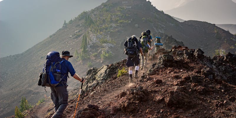
7. Manitou Incline
Distance: 1 mile up (2,768 steps) | Elevation gain: 2,000 ft | Time: 1-2 hours up, 1 hour down (Barr Trail)
The most famous (and infamous) hike in Colorado Springs. 2,768 railroad tie steps straight up the mountain. Average grade of 41%, with sections hitting 68%. Not a hike — a stairmaster from hell with views.
Tips: Start before 8 AM. Bring more water than you think. You MUST descend via Barr Trail (no going down the Incline). Free parking fills up early — consider the shuttle from the Iron Springs Chateau lot.
8. Mount Cutler Trail
Distance: 2 miles round trip | Elevation gain: 700 ft | Time: 1-1.5 hours
Short but steep trail in North Cheyenne Canyon with a spectacular viewpoint at the summit. You can see Seven Falls, the Broadmoor, and the city below. One of the best effort-to-reward ratios in the Springs.
9. Barr Trail to Barr Camp
Distance: 12 miles round trip | Elevation gain: 3,400 ft | Time: 5-7 hours
The Pikes Peak trail, but you do not have to summit. Barr Camp at 10,200 feet is a backcountry cabin with snacks, drinks, and the best porch in Colorado. The trail is well-maintained and beautiful through aspen and pine forest.
Extreme (Full-Day Commitments)
10. Pikes Peak via Barr Trail
Distance: 26 miles round trip | Elevation gain: 7,400 ft | Time: 10-14 hours
The ultimate Colorado Springs hike. Summit at 14,115 feet with views of four states. Start at 3-4 AM, bring layers for every season (it can snow on top in July), and be below treeline before afternoon thunderstorms hit. Not for beginners.
11. Seven Bridges Trail
Distance: 7 miles round trip | Elevation gain: 1,800 ft | Time: 4-6 hours
A rugged, unmaintained trail that crosses seven wooden bridges over a creek in North Cheyenne Canyon. Scrambling required in sections. One of the most adventurous hikes near the city. Not marked on most maps.
12. The Crags
Distance: 4 miles round trip | Elevation gain: 800 ft | Time: 2-3 hours
West of Pikes Peak near Divide, CO (30 min from COS). Granite rock formations with scrambling opportunities and 360-degree views. Less crowded than anything in the city.
What to Bring
- Water: More than you think. Colorado is dry and you are at 6,000+ feet altitude.
- Sunscreen: UV is 25% stronger at altitude than sea level.
- Layers: Morning temps can be 30 degrees cooler than afternoon.
- Snacks: Trail mix, bars, fruit. You burn more calories at altitude.
Plan Your Hiking Trip
Use our AI trip planner to build a full Colorado Springs itinerary around your favorite trails. It is free and considers your fitness level and interests.
More guides: Free Things to Do | Dog-Friendly Trails | 10 Unique Things to Do
